Viewable by the world
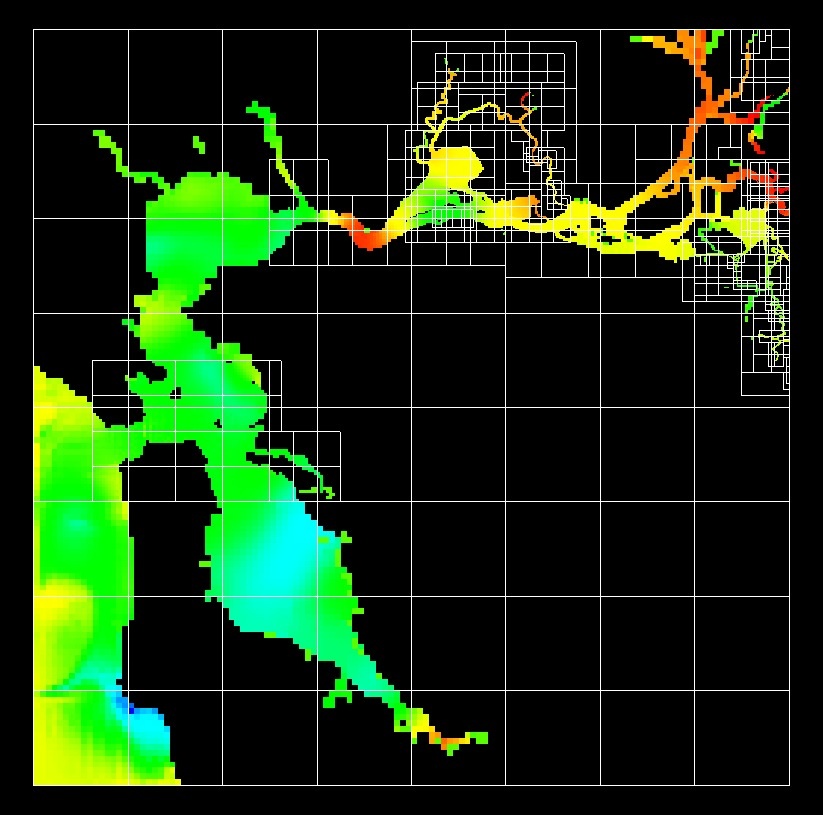
CFD Modeling of San Francisco Bay and Delta
- Two thirds of the water in California passes through the Sacramento-San Joaquin Delta, providing drinking water for 22 million Californians and supporting agriculture valued at tens of billions of dollars. In addition, many fish species live and migrate through the Delta, including endangered species such as salmon and smelt. However, California's water supply and wildlife habitat are threatened by fragile levees, land subsidence, agricultural run-off, climate change and population growth. Present and anticipated crises, as well as proposals for large infrastructure projects in an increasingly inflexible landscape, lead to the need for high-fidelity computational tools for hydrodynamic modeling.
- Lawrence Berkeley National Laboratory and the California Department of Water Resources collaborate on an open-source hydrodynamic, transport, and particle tracking model (REALM). Estuary systems of bays and channels comprise our problem domains, over which we discretize the shallow water equations. These equations represent the conservation of mass and momentum in one and two dimensions, including the effects of varying bathymetry and source terms. When completed, REALM will contribute to controversial water-policy debates in California through estimates of salinity, transport of pollutants, and the survival of young fish.
- Long term model goals
- Faithful representation of the shoreline
- Simulation of the entire SF Bay and Delta
- Simulation of one and two dimensional flows
- Simulation of tidal mudflats, levee breaks, and floods
- Design decisions
- Embedded boundary methods
- Conservative discretization
- Adaptive mesh refinement
- Parallel computation
Chombo algorithms and software components.
- Finite volume discretization of the shallow water equations builds on existing discretizations of conservation equations and divergence operators.
- Digital elevation maps lead to an implicit function representation of the bathymetry, facilitating rapid calculation of an embedded boundary Cartesian grid representation of the shoreline.
- Off-the-shelf adaptive mesh refinement and parallel computation.
- Bathymetry effects and complex 2D domains require algorithm changes.
- Leads to varying coefficients in the flux functions.
- Requires the calculation of geometry parameters in 3D.
- Performance dominated by shoreline cells.
- Current capability and immediate future goals.
- Realm supports modeling in one and two dimensions as well as particle tracking.
